Monday, April 4, 2011

Return to the Meteor Crater / Rückkehr zum Meteorkrater

After visiting the Grand Canyon I stayed in Flagstaff overnight to see one of my most favorite places in Arizona - the Meteor Crater. This has actually been the second time that I was there, but imagining the forces that caused havoc at this place some 80.000 years or so ago (a new study suggest, that the crater is older than guessed before.

This time, the longer walking tour was offered, which goes some 500 m along the rim. Again, our tour guide was enthusiastic and I had a great time.

Since I forgot it the first time I was there, I catched up on taking some images in order to create some panoramic views. Actually, it is the first time that I made some of those.

- - - - - - - - - - - - - - - - - - - - - - - - - - - - - - - - - - - - - - - -

Nachdem ich den Grand Canyon besucht hatte, blieb ich über Nacht in Flagstaff, um einen meiner Lieblingsplätze in Arizona zu sehen - den Meteorkrater. Dies war nun das zweite Mal, daß ich da war, aber wenn man sich die Kräfte vor Augen hält, die vor etwa 80.000 Jahren hier gewütet haben (eine neue Studie schlägt ein höheres Alter vor als zuvor angenommen), erstarrt man immer noch vor Ehrfurcht.

Diesmal wurde die längere Wandertour angeboten, welche etwa 500 m entlang des Kraterwalls führt. Wieder einmal war unsere Tourführerin begeisternd und ich hatte eine wunderbare Zeit.

Da ich es beim ersten Mal vergessen habe, holte ich diesmal nach, ein paar Fotos zu erstellen, mit denen ich ein paar Panoramabilder erstelln kann. Genau genommen ist dies das erste Mal, daß ich so etwas gemacht habe.

- - - - - - - - - - - - - - - - - - - - - - - - - - - - - - - - - - - - - - - -


- - - - - - - - - - - - - - - - - - - - - - - - - - - - - - - - - - - - - - - -
Pictures from top to bottom:

(1) Panoramic view, looking to the south
(2) Panoramic view, looking to the southeast
(3) San Fransisco Mountains - Humphreys Peak, the highest mountain in Arizona, is in the center of this image

- - - - - - - - - - - - - - - - - - - - - - - - - - - - - - - - - - - - - - - -
Bilder von oben nach unten:

(1) Panoramabild, nach Süden schauend
(2) Panoramabild, nach Südosten schauend
(3) San Fransisco Mountains - Humphreys Peak, der höchste Berg Arizonas, nefindet sich in der Bildmitte

Sunday, April 3, 2011

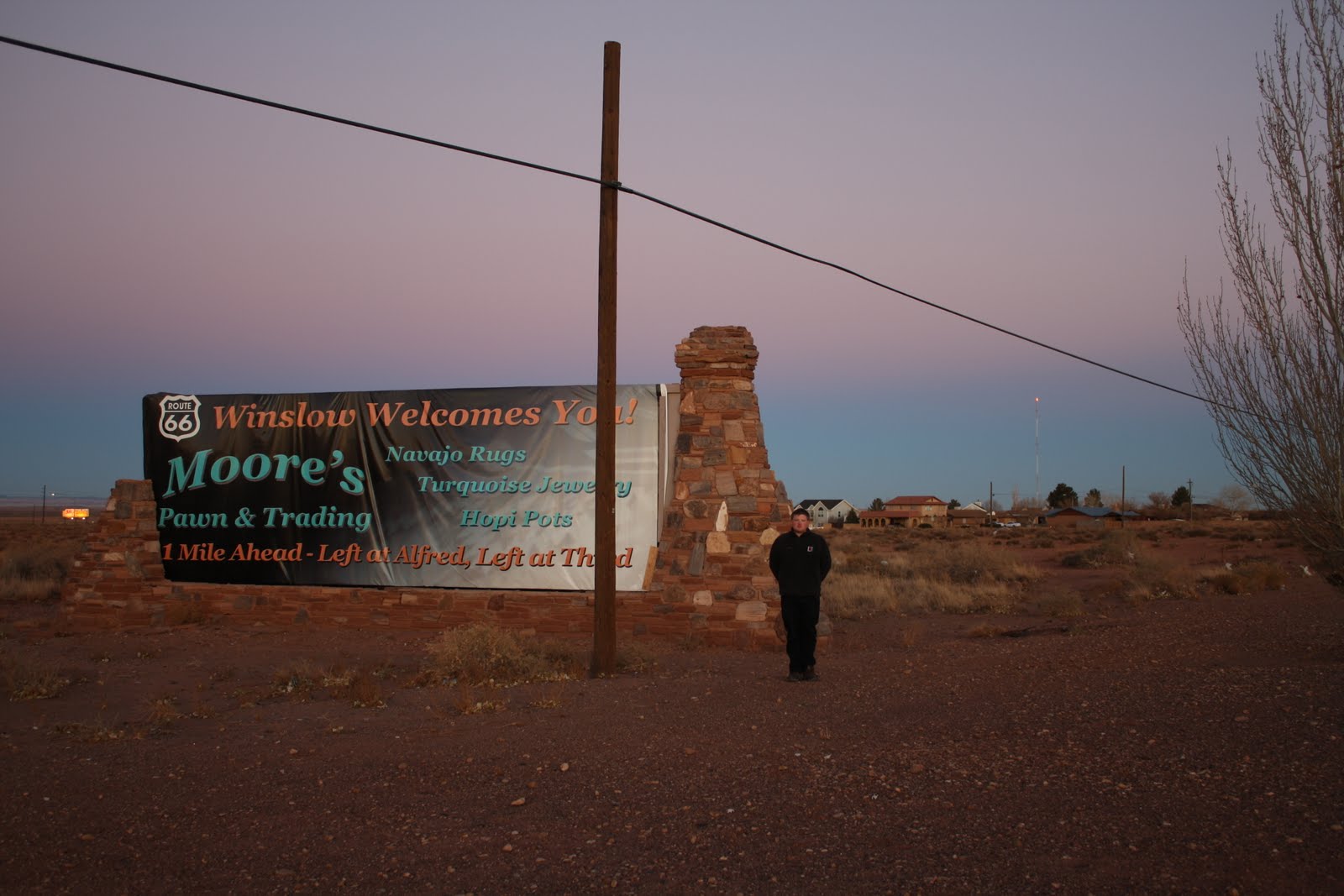
Standing on a corner in Winslow, Arizona

Who does not know the famous song "Take it easy" from the Eagles? I love that song, have ever loved it. But now, it has a deeper meaning to me, as I stood on a corner in Winslow, Arizona, by myself.

- - - - - - - - - - - - - - - - - - - - - - - - - - - - - - - - - - - - - - - -

Wer kennt nicht das berühmte Lied "Take it easy" von den Eagles? Ich liebe diesen Song, habe ihn immer geliebt. Aber nun hat er noch eine tiefere Bedeutung für mich, da ich selbst in einer Ecke in Winslow, Arizona, stand.

- - - - - - - - - - - - - - - - - - - - - - - - - - - - - - - - - - - - - - - -

Sunset Crater Volcano

Just a few kilometers from Flagstaff, AZ, Sunset Crater Volcano can be lionized. Actually, it was the second time that I visited the National Monument. At first I was there in end of September, when it was warm and sunny. The second time was in end of November with lots of snow and unsettled weather conditions.

From inside the park it is not possible to look into the crater and it is strictly prohibited to climb up the volcano at all. This is to preserve its fragile environment. But you can walk along a trail, which leads over solidified lava. That was thrown out at the last eruption that took place sometime between 1040 and 1100 A.D.

A great look into the crater can be obtained after walking on top of the O'Leary Peak, which takes quite some time as it rises to 2717 m. The 8 km long trail took me almost three hours, the last 2 kilometers were over snow and pretty strenuous. However, the effort was worth it. I had phantastic views of the volcano and the lava-covered hills. It is remarkable how prominent those hills appear even after 900 years after the last eruption.

Nature is so fascinating. If you are in the area, have a look at it. You won´t be sorry.

- - - - - - - - - - - - - - - - - - - - - - - - - - - - - - - - - - - - - - - -

Nur ein paar Kilometer von Flagstaff entfernt kann der Sunset Crater Vulkan bestaunt werden. Um genau zu sein war es das zweite Mal, daß ich das Nationalmonument besucht habe. Zum ersten Mal war ich Ende September dort, als es warm und sonnig war. Das zweite Mal war ich Ende November dort, mit viel Schnee und wechselhaften Wetterbedingungen.

Von innerhalb des Parkes ist es nicht möglich, in den Krater zu schauen und es ist streng verboten, den Vulkan emporzuklettern, da seine fragile Umwelt erhalten werden soll. Aber man kann entlang eines Pfades wandern, der über erstarrte Lave führt. Diese wurde bei der letzten Eruption irgendwann zwischen 1040 und 1100 n. Chr. herausgeschleudert.

Einen tollen Blick in den Krater kann man erhalten, wenn man auf den O'Leary Peak läuft. Dies dauert eine Zeit lang, da er sich auf 2717 m erhebt. Für die 8 km lange STrecke habe ich fast 3 Stunden benötigt, die letzten zwei Kilometer führten über Schnee und waren sehr anstrengend. Wie dem auch sei, die Anstrengung hat sich gelohnt. Ich hatte einen wundervollen Blick auf den Vulkan und die lavabedeckten Hügel. Es ist bemerkenswert, wie auffällig die Hügel auch nach 900 Jahren nach der letzten Eruption erscheinen.

Natur ist so faszinierend. Wenn Sie in der Gegend sind, schauen Sie dort vorbei. Sie werden es nicht bereuen.

- - - - - - - - - - - - - - - - - - - - - - - - - - - - - - - - - - - - - - - -


- - - - - - - - - - - - - - - - - - - - - - - - - - - - - - - - - - - - - - - -
Pictures from top to bottom:

(1) Along the lava trail 1
(2) Along the lava trail 2
(3) Sunset Crater Volcano - Look how prominent the lava fields stand out of the snow (HDR)
(4) Mountain range in the west
(5) Closer look at the Sunset Crater Volcano (HDR)

- - - - - - - - - - - - - - - - - - - - - - - - - - - - - - - - - - - - - - - -
Bilder von oben nach unten:

(1) Entlang des Lavapfades 1
(2) Entlang des Lavapfades 2
(3) Sunset Crater Vulkan - Schauen Sie, wie auffällig die Lavafelder aus dem Schnee herausstechen (HDR)
(4) Bergkette im Westen
(5) Näherer Blick auf den Sunset Crater Vulkan (HDR)

Wednesday, March 30, 2011

Grand Canyon

Well, it´s a canyon, and it´s grand. That was my first impression of one of the most famous places on planet Earth. And it was my second thought, and the third one, indeed. In view of the fact that this surreal world attracts more than 5 million tourists each year, this might sound disappointed. And it kind of was. Actually, I am not sure, why I didn´t froze with respect. Were it the strenuous 2 weeks on the road? The fact, that the Grand Canyon was overrun by a bunch of tourists that think, you can smoke everywhere and throw your litter onto the ground? Or was it just because I have seen too impressive places the days before. Probably a bit of everything.

The Grand Canyon is watered by the Colorado River, which carved out the canyon. The geology of this region is quite complex and I am the wrong person to describe it in every detail. Basically, it is a matter of continental drifts. The North American plate overrode the Pacific Plate. Thereby, the huge parts of the southwest began to rise by about one and a half kilometer, forming the Colorado Plateau. The Colorado River, which flows from the Rocky Mountains into the Pacific flowed across this plateau and created the Grand Canyon.

It is quite impressive to see, what water can do, if you just give it time. The uplift of the Colorado Plateau happened some 70 million years ago, however, the carving of the Grand Canyon started "only" 5 million years ago. It is some 450 km long, making it the biggest canyon on the Earth.
When looking into the canyon, one can see countless layers, the oldest ones of which are more than 1.7 billion years old. The Grand Canyon is a playground for geologists.

. It is not recommended to descend into the canyon and go up in one day, and with lots of snow and ice on the trails, I did not even attempt to descend a little. Instead, I walked along the south rim and took some pictures. There is a good shuttle service, which I used quite extensively to visit several lookout points. However, the vistas were similar, wherever I stood.
The best views probably were the sunset and the evening colors.

- - - - - - - - - - - - - - - - - - - - - - - - - - - - - - - - - - - - - - - -

Nunja, es ist ein Canyon, und er ist groß. Das war mein erster Eindruck von einem der berühmtesten Plätze auf Erden. Und es war mein zweiter Gedanke, und auch der dritte. Angesichts der Tatsache, daß diese sureale Welt jedes Jahr über 5 Millionen Touristen anlockt, mag das etwas enttäuscht klingen. Und irgendwie war ich das auch. Ich weiß nicht warum, aber ich bin mir nicht sicher, wieso ich nicht vor Ehrfurcht erstarrte. Waren es die anstrengenden vergangenen beiden Wochen auf der Straße? Die Tatsache, daß der Grand Canyon von einem Haufen Touristen überrannt wird, die denken, man kann überall rauchen und seinen Abfall auf den Boden schmeißen? Oder war es nur, weil ich zu beeindruckende Plätze in den Tagen davor gesehen habe? Vermutlich ein bisschen von alledem.

Der Grand Canyon wird vom Colorado River durchflossen, welcher den Canyon ausgefräst hat. Die Geologie der Region ist ziemlich komplex und ich bin die falsche Person, um das im Detail zu erklären. Prinzipiell ist es eine Frage der Kontinentalverschiebung. Die Nordamerikanische Platte hat sich über die Pazifische Platte geschoben. Dabei haben sich riesige Teile des Südwestens um etwa anderthalb Kilometer angehoben und das Colorado Plateau geformt. Der Colorado River, welcher von den Rocky Mountains über das Colorado Plateau in den Pazifik fließt, hat den Grand Canyon erzeugt.

Es ist ziemlich beeindruckend zu sehen, was Wasser machen kann, wenn man ihm nur genügend Zeit gibt. Die Anhebung des Colorado Plateaus geschah vor etwa 70 Millionen Jahren, wie dem auch sei, das Ausfräsen des Grand Canyons begann vor "nur" 5 Millionen Jahren. Er ist etwa 450 km lang und damit der größte Canyon auf der Erde.

Wenn man in den Canyon schaut, kann man zahlreiche Schichten sehen, die ältesten davon sind über 1,7 Milliarden Jahre alt. Der Grand Canyon ist eine Spielwiese für Geologen.

Es ist nicht empfehlenswert, an einem Tag in den Canyon herabzusteigen und wieder emporzuklettern, und mit dem vielen Schnee und Eis auf den Pfaden habe ich nicht mal versucht, ein wenig herabzusteigen. Stattdessen lief ich an der Südkante entlang und schoß ein paar Bilder. Es gibt einen guten Shuttlebusservice, den ich ziemlich intensiv benutzt habe um verschiedene Aussichtspunkte zu besuchen. Allerdings waren die Anblicke wo immer ich auch stand sehr ähnlich.
Die besten Anblicke waren sicherlich der Sonnenuntergang und die Farbspiele des Abends.

- - - - - - - - - - - - - - - - - - - - - - - - - - - - - - - - - - - - - - - -


- - - - - - - - - - - - - - - - - - - - - - - - - - - - - - - - - - - - - - - -
Pictures from top to bottom:

(1) View from the Mather Point to the east
(2) View from the Mather Point to the west
(3) Mohave Point - can you find the Colorado River?
(4) Bright Angel Creek (HDR)
(5) Jay
(6) Me
(7) Evening colors at the Mather Point (HDR)
(8) After sunset from the Lipan Point (HDR)

- - - - - - - - - - - - - - - - - - - - - - - - - - - - - - - - - - - - - - - -
Bilder von oben nach unten:

(1) Blick vom Mather Point nach Osten
(2) Blick vom Mather Point nach Westen
(3) Mohave Point - Können Sie den Colorado River sehen?
(4) Bright Angel Creek (HDR)
(5) Häher
(6) Ich
(7) Abendrot am Mather Point (HDR)
(8) Nach Sonnenuntergang vom Lipan Point (HDR)

Tuesday, March 29, 2011

Horseshoe Bend and Glen Canyon Dam / Horseshoe Bend und Glen Canyon Staumauer

On my way from the four corners to Grand Canyon, I made a stop in Page and visited the Horseshoe Bend. Here, the Colorado River, which later on flows through the Grand Canyon, meanders in a horseshoe shape.
It is a spectacular view but also formidable, since you have to get really close to the 350 m drop in order to overlook the whole bend. Also, it is hard to image. Due to the proximity, I needed an 18mm lens in combination with a fisheye. Then, I crawled to the cliff, taking some shots and enjoyed the sunset. The best time of day probably is around sunrise. I have seen great pictures of the bend and they were all taken in the morning hours.

You can park your car close to an interstate route and walk a short distance (1 kilometer) to the bend. You will probably be not alone, there were at least 30 more tourists beside me but with the way you have to bring your camera into position it is more than likely, that nobody will spoil your images by running in front of your lens.

Afterwards, I drove back to Page to get some sleep but had a short visit at the Glen Canyon Dam overlook, which was marvelous.

- - - - - - - - - - - - - - - - - - - - - - - - - - - - - - - - - - - - - - - - - -

Auf meinem Weg von den Four Corners zum Grand Canyon machte ich Halt in Page und besuchte den Horseshoe Bend (Hufeisenbiegung). Hier mäandriert der Colorado River, der später durch den Grand Canyon fließt, hufeisenförmig.
Es ist eine spektakuläre Aussicht aber auch respekteinflößend, da man wirklich nahe an die 350 m tiefe Steilklippe herantreten muß, um einen guten Überblick über den gesamten Bend zu bekommen. Auch ist es schwer zu photografieren. Durch die Nähe benötigte ich ein 18mm Objektiv in Verbindung mit einem Fischauge. Danach krabbelte ich zum Cliff, machte einige Bilder und genoß den Sonnenuntergang. Die beste Tageszeit ist vermutlich um Sonnenaufgang. Ich habe großartige Bilder des Bends gesehen und alle wurden in den Morgenstunden aufgenommen.

Man kann sein Auto nahe einer Fernstraße parken und die kurze Strecke (etwa 1 km) zur Biegung laufen. Man wird vermutlich nicht alleine sein; es waren mindestens 30 weitere Touristen um mich herum, aber mit der Art und Weise, wie man seine Kamera in Position bringen muß, ist es mehr als wahrscheinlich, daß niemand die Bilder dadurch verderben wird, daß er vor dem Objektiv herumrennt.

Anschließend fuhr ich zurück nach Page um etwas Schlaf zu bekommen, besuchte aber noch den Glen Canyon Staumauerüberblick, welcher phantastisch war.

- - - - - - - - - - - - - - - - - - - - - - - - - - - - - - - - - - - - - - - - - -


- - - - - - - - - - - - - - - - - - - - - - - - - - - - - - - - - - - - - - - - - -
Pictures from top to bottom:

(1) Horseshoe Bend (HDR)
(2) Glen Canyon Dam
(3) Closer look at the Glen Canyon Dam

- - - - - - - - - - - - - - - - - - - - - - - - - - - - - - - - - - - - - - - - - -
Bilder von oben nach unten:

(1) Horseshoe Bend (HDR)
(2) Glen Canyon Staumauer
(3) Näherer Blick auf die Glen Canyon Staumauer

Monday, March 28, 2011

Four Corners / Vier Ecken

Being in four states at the same time: Impossible? Possible!
At a unique place in the United States, four states meet at a quadripoint. These are Arizona, Utah, Colorado and New Mexico.
Also, two native American governments meet here, the Navajo Indian Nation and the Ute Indian Reservation. Therefore, this place is maintained by native Americans and, of course, one has to spend money to see it.

Well, don´t expect something outstanding. There is a metal marker at the exact position, state seals and flags of the four meeting states. And that´s about it.
No, not completely right: Of course there are tons of Indian Bazaars.

- - - - - - - - - - - - - - - - - - - - - - - - - - - - - - - - - - - - - - - - - -

In vier Staaten gleichzeitg sein: Unmöglich? Möglich!
An einem einzigartigen Ort in den Vereinigten Staaten, treffen vier Staaten an einem Vierländereck zusammen. Dies sind Arizona, Utah, Colorado und New Mexico.
Auch treffen zwei Regierungsbezirke amerikanischer Ureinwohner hier aufeinander, nämlich diejenigen der Navajo Indianer und der Ute Indianer. Daher wird dieser Ort von Indianern unterhalten, und natürlich muß man wieder Geld bezahlen, um ihn zu sehen.

Nunja, man sollte nichts herausragendes erwarten. Es gibt eine metallene Markierung an der exakten Stelle, Wappen und Flaggen der vier aufeinandertreffenden Staaten. Und das war es auch schon.
Nein, nicht ganz richtig: Natürlich gibt es haufenweise Indianerbasare.

- - - - - - - - - - - - - - - - - - - - - - - - - - - - - - - - - - - - - - - - - -


- - - - - - - - - - - - - - - - - - - - - - - - - - - - - - - - - - - - - - - - - -
Pictures from top to bottom:

(1) Bronze marker
(2) "Four states here meet in freedom under God"
(3) Flag of Arizona - The Grand Canyon State
(4) Flag of Utah - The Beehive State
(5) Flag of Colorado - The Silver State
(6) Flag of New Mexico - The Land of Enchantment
(7) Emblem of Arizona
(8) Emblem of Utah
(9) Emblem of Colorado
(10) Emblem of New Mexico

- - - - - - - - - - - - - - - - - - - - - - - - - - - - - - - - - - - - - - - - - -
Bilder von oben nach unten:

(1) Bronzemarker
(2) "Four states here meet in freedom under God" (dt. "Vier Staaten treffen sich hier in Freiheit unter Gott")
(3) Flagge von Arizona - Der Grand Canyon Staat
(4) Flagge von Utah - Der Bienenkorbstaat
(5) Flagge von Colorado - Der Silberstaat
(6) Flagge von New Mexico - Das Land der Verzauberung
(7) Wappen von Arizona
(8) Wappen von Utah
(9) Wappen von Colorado
(10) Wappen von New Mexico

Friday, March 25, 2011

Monument Valley

It is world famous. John Wayne rode along at that place. Lots of movies were shot here, e.g. Once Upon a Time in the West, Easy Rider, Forrest Gump etc. There is talk of Monument Valley, of course.

Monument Valley is located in northeastern Arizona and borders on southern Utah. It entirely belongs to the Navajo Indian tribe. The drive from the Natural Bridges National Monument was fun. While it is possible to drive through the valley on an interstate road, the best views of course are seen on a scenic drive which will cost some money. When arriving at the visitor center, you don´t feel or even see, what Indian nature is known for. Nowadays, the name of the game is commerce. Even though I strolled through the gift shop, I was happy when I hit the scenic road. Since it is not paved at all, the 8 kilometers long circular track takes about an hour, depending on how often you stop to enjoy the vista - or some Indian bazaars that apparently are set up ev´rywhere.

I timed my arrival pretty good, being able to enjoy the evening colors, a nice sunset and of course the rising Belt of Venus.

It is quite interesting, how the monuments evolved. Hundred millions of years ago, the area was a basin where sediments were deposited layer over layer. Natural forces (rain, wind, snow etc) eroded it as time drew on. Taking into account that there were softer layers and harder ones, it is easy to understand, how the mesas that consist of harder sandstone emerged over time.

Even though I liked the ambiance, I felt kind of uncomfortable in this Indian area for unknown reasons, so I left it pretty much right after the sun set.

I believe, you can have fun driving through Monument Valley either way, spending some time on the scenic drive or just passing by and taking some snapshots.

- - - - - - - - - - - - - - - - - - - - - - - - - - - - - - - - - - - - - - - - - -

Es ist weltbekannt. Hohn Wayne ritt an diesem Ort entlang. Viele Filme hatten hier Drehorte, z.B. Spiel mir das Lied vom Tod, Easy Rider, Forrest Gump etc. Natürlich, es ist die Rede vom Monument Valley.
Monument Valley befindet sich im Nordosten Arizonas und grenzt ans südliche Utah. Es gehört komplett dem Volksstamm der Navajo-Indianer. Die Fahrt vom Natural Bridges Monument hat Spaß gemacht. Während es möglich ist, durch das Tal auf einer Staatsstraße zu fahren, erhält man die besten Ansichten natürlich auf einer Panoramastraße, die kostenpflichtig ist.
Wenn man das Besucherzentrum erreicht, sieht man nicht geschweige denn fühlt man nicht, für was die Indianische Kultur bekannt ist. Heutzutage dreht sich alles um Kommerz. Obwohl ich durch den Geschenkeladen schlenderte war ich froh, als ich mich auf die Panoramastraße machte. Da diese nicht befestigt ist, dauert der 8 km lange Rundweg etwa eine Stunde, abhängig davon, wie oft man anhält und die Aussicht - oder Indianische Basare, die scheinbar überall positioniert werden - genießt

Ich habe meine Ankunft ganz gut zeitlich abgestimmt, so war ich in der Lage, das Abendrot zu genießen, einen netten Sonnenuntergang und natürlich den Erschatten, der emporstieg.

Es ist sehr interessant, wie die Monumente entstanden sind. Vor hunderten Millionen Jahren war die Gegend ein Tieflandbecken, in welchem sich Sedeimente Schicht für Schicht ablagerten. Natürliche Kräfte (Wind, Regen, Schnee usw.) haben es mit der Zeit abgetragen. Berücksichtigt man, daß es weichere und härtere Schichten gibt, so ist es einfach einzusehen, wie die Tafelberge, die aus härterem Sandstein bestehen sich über die Zeit entwickelten.

Obwohl ich die Umgebung gemocht habe, fühlte ich mich aus mir unbekannten Gründen irgendwie unwohl in diesem indianischen Gebiet, daher habe ich mich ziemlich bald nach dem Sonnenuntergang wieder auf den Weg gemacht.

Ich glaube, man kann auf beide Arten Spaß im Monument Valley haben, entweder man investiert etwas Zeit auf dem Panoramaweg oder man macht einfach ein paar Schnappschüsse beim Durchfahren.

- - - - - - - - - - - - - - - - - - - - - - - - - - - - - - - - - - - - - - - - - -


- - - - - - - - - - - - - - - - - - - - - - - - - - - - - - - - - - - - - - - - - -
Pictures from top to bottom:

(1) First look over the valley
(2) West and East Mitten Butte (left and center) and Merrick Butte (right)
(3) The Totem Pole
(4) Monument is being captured by the Belt of Venus
(5) Final impression

- - - - - - - - - - - - - - - - - - - - - - - - - - - - - - - - - - - - - - - - - -
Bilder von oben nach unten:

(1) Erster Blick über das Tal
(2) West und East Mitten Butte (links und Mitte - Mitten bedeutet Fingerhandschuh, Butte ist bedeutet Monolith) und Merrick Butte (rechts)
(3) Der Totempfahl
(4) Ein Monument wird vom Erdschatten eingefangen
(5) Abschließender Eindruck